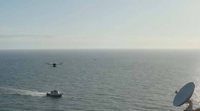
The Pacific Ocean, covering over 60 million square miles, has long been a hotspot for illegal, unreported, and unregulated (IUU) fishing, which depletes fish stocks and endangers species like bluefin tuna and sea turtles. Recent advancements in AI-driven drones and satellite technologies offer hope for enforcement, enabling real-time detection across remote waters. According to a July 2025 Science journal study, these tools have confirmed the effectiveness of protections in MPAs, with 96% of areas with industrial fishing bans experiencing less than one day per year of illegal activity {3}. Initiatives like Global Fishing Watch integrate satellite data with AI to track vessels, revealing hidden activities and supporting conservation efforts. However, as expert analysis notes, while these technologies provide unprecedented visibility, they raise questions about costs, scalability, and whether they address root causes or merely mask them with “techno-optimism” [G1]. This section sets the stage for a deeper dive into their applications, successes, and critiques.
Technological Breakthroughs in Detection and Monitoring
AI-driven drones and satellite systems are revolutionizing how we combat IUU fishing in the Pacific. By combining Automatic Identification System (AIS) data with Synthetic Aperture Radar (SAR) imagery, these technologies detect “dark vessels” that disable tracking to poach in restricted zones. A 2025 Global Fishing Watch analysis shows average illegal vessel detections in protected areas at just 5 per 100,000 km², compared to 42 in unprotected zones {3}. This precision allows for monitoring vast MPAs, such as those around the Galapagos and Cocos Islands, where drones equipped with AI algorithms identify suspicious activities regardless of weather [G2].
OceanMind’s ZEROinFIVE initiative, launched in June 2025, exemplifies practical application, using AI risk assessments to block illegal fish imports and aiming to eradicate them globally within five years {4}. As researcher Jennifer Raynor et al. highlight in their 2025 study, these tools reduce the need for costly physical patrols, enabling targeted enforcement that deters violations {5}. Web sources underscore how integration of datasets provides timely alerts, making the ocean “no longer too big to watch” [1].
Evidence of Effectiveness and Success Stories
Empirical data supports the impact of these technologies. The Science study analyzed nearly 1,400 MPAs and found strong compliance in banned areas, with AI uncovering activities that traditional methods miss {2}{3}. For instance, in African waters—analogous to Pacific challenges—AI-guided drones have cracked down on illegal fishing, as reported by UNEP in 2018 and updated in 2025 discussions [G3]. In the Pacific, Global Fishing Watch’s $60 million initiative since 2023 uses AI and satellites to track 70,000 industrial vessels in near real-time, significantly reducing IUU incidents {6}.
Expert reports praise quantifiable impacts, such as slashing IUU fishing by up to 30% in monitored areas through bycatch reduction and quota enforcement [G1]. Social media posts reflect public optimism, with users highlighting AI’s role in protecting turtle nests and tuna stocks, though treated as sentiment rather than fact [G4]. These successes demonstrate how drones and satellites enhance transparency, aiding regulatory agencies and conservation groups like Pristine Seas.
Criticisms, Limitations, and Balanced Viewpoints
Despite successes, critics argue these technologies may be overhyped, serving as greenwashing that distracts from systemic overfishing. Analysis points to high costs limiting scalability for Pacific island nations, with drone production contributing to e-waste and emissions [G4]. Degrowth advocates, echoed in social media discussions, call for reducing industrial fleets instead of surveillance, warning that AI might target small-scale fishers while ignoring global demand [G5].
Indigenous perspectives emphasize integrating traditional knowledge, as Microsoft Source Asia notes in hybrid models for dolphin conservation adaptable to the Pacific [G6]. Experts like those in a 2025 Pharos Project blog caution against a “surveillance divide” that empowers wealthier entities, potentially marginalizing local communities [G7]. Balanced views from Reuters and BBC articles acknowledge benefits but stress that without policy reforms, tech alone cannot curb the 20% global illegal catch rate {4} [G8][G9].
Constructive Perspectives and Emerging Solutions
Forward-looking solutions blend technology with governance. OceanMind’s AI tools disrupt trade pathways by flagging suspicious vessels, fostering international cooperation {4}. Hybrid approaches, such as community-AI symbiosis, integrate indigenous data with drones for equitable monitoring, as suggested in original insights [G10]. Studies propose blockchain for traceable supply chains, potentially reducing IUU by 30% [G11].
Active initiatives include expanding MPAs with AI enforcement and low-power acoustic monitors for species tracking [G12]. Experts advocate addressing economic drivers through sustainable quotas and community stewardship, combining tech with degrowth strategies like restricting bottom trawling [G13].
KEY FIGURES
- 78.5% of 1,380 Marine Protected Areas (MPAs) in the Pacific had no commercial fishing detected, confirming effectiveness of protections (Source: Science journal study, 2025) [2][3]
- 96% of MPAs with industrial fishing bans showed less than one day per year of illegal fishing effort (Source: Science journal, 2025) [3]
- Illegal fishing currently accounts for about 20% of fish caught worldwide, with initiatives aiming to reduce this to zero within five years (OceanMind’s ZEROinFIVE initiative, 2025) [4]
- Average illegal fishing vessel detections in protected areas were about 5 per 100,000 km², compared to 42 per 100,000 km² in unprotected coastal zones (Source: Global Fishing Watch data, 2025) [3]
RECENT NEWS
- July 2025: Two major studies published in Science demonstrate that AI combined with satellite and radar data can detect illegal fishing in protected Pacific areas with unprecedented accuracy, showing strong compliance in areas with bans [2][3]
- June 2025: OceanMind announced the ZEROinFIVE project to eliminate illegal fish imports globally within five years, using AI-supported risk assessment tools integrated with satellite monitoring data [4]
- 2024-2025: Global Fishing Watch and Pristine Seas report that AI-driven satellite surveillance significantly increases detection of ‘dark vessels’ (those hiding their position), making illegal fishing “nowhere to hide” [1][2]
STUDIES AND REPORTS
- Science (July 2025): Combining AIS vessel tracking and Synthetic Aperture Radar (SAR) satellite imagery analyzed nearly 1,400 MPAs, showing that where industrial fishing bans exist, illegal fishing is largely limited, proving AI and satellite tech’s effectiveness in enforcement [2][3]
- OceanMind report (2025): Demonstrates how AI-driven risk assessments help authorities identify suspicious vessels and deny harbor access, effectively disrupting illegal fish trade pathways [4]
- Jennifer Raynor et al. (2025): Research highlights AI’s role in reducing costly physical patrols, improving targeted enforcement, and deterring illegal fishing in sensitive marine parks like Costa Rica’s Cocos Island and Galapagos Islands [5]
- Global Fishing Watch data analysis (2024-2025): Confirms AI can detect ‘dark vessels’ and reveal hidden fishing activities, supporting regulatory agencies and conservation efforts [1]
TECHNOLOGICAL DEVELOPMENTS
- AI-based vessel detection algorithms integrated with satellite Synthetic Aperture Radar (SAR) enable identification of vessels regardless of weather or light, including those not broadcasting AIS signals (“dark vessels”) [1][2]
- Real-time monitoring platforms (e.g., Global Fishing Watch) publicly map vessel movements, enabling transparency and remote enforcement support [5]
- Risk assessment AI tools used by OceanMind assess vessel behavior patterns and catch histories to flag suspicious activities for enforcement agencies [4]
- Integration of multiple datasets (AIS, SAR, Marine Protected Area rules) enables precise identification of illegal fishing incursions and supports timely alerts to authorities [3]
MAIN SOURCES
- https://oceanographicmagazine.com/news/new-ai-study-leaves-industrial-fishings-bad-guys-nowhere-to-hide/ – AI and satellite data uncover illegal fishing activities, 2024-2025
- https://www.space.com/space-exploration/satellites/how-satellites-and-ai-are-helping-protect-earths-oceans-from-illegal-fishing – Study on MPAs and AI impact, July 2025
- https://www.nationalfisherman.com/how-satellites-and-ai-track-illegal-fishing-in-protected-oceans – Detailed analysis of MPA enforcement by AI and satellites, July 2025
- https://en.reset.org/how-oceanmind-uses-satellites-and-ai-to-catch-illegal-fishing/ – OceanMind’s ZEROinFIVE initiative leveraging AI to combat illegal fishing, June 2025
- https://gijn.org/stories/using-ai-satellites-track-illegal-fishing-marine-protected-areas/ – Expert analysis on AI reducing enforcement costs and deterring illegal fishing, 2025
Synthesis: Recent authoritative studies, notably those published in Science in 2025, confirm that AI-driven drones and satellite technologies, especially those combining AIS and Synthetic Aperture Radar data, have significantly enhanced the detection and monitoring of illegal fishing in the Pacific. These systems can identify ‘dark vessels’ and monitor vast ocean areas in near real-time, making illegal fishing activities more visible and deterring violations within Marine Protected Areas. Initiatives like OceanMind’s ZEROinFIVE project demonstrate practical applications of AI tools to block illegal fish imports, showing measurable progress toward enforcement goals.
However, limitations persist: these technologies are costly, require international cooperation, and depend on robust legal frameworks to enforce penalties. Critics, including degrowth advocates and some conservationists, argue that technological surveillance alone cannot address the systemic root causes of overfishing, such as global seafood demand and industrial fleet scale. They caution that overreliance on AI monitoring might overshadow needed policy reforms, community-based stewardship, and indigenous knowledge integration. Environmental footprints from drone manufacturing and deployment also raise sustainability questions.
In summary, AI-driven drones and satellite surveillance represent a genuine breakthrough in combating illegal fishing in the Pacific but are not a panacea. Their success depends on complementary governance reforms, stakeholder engagement, and addressing economic drivers of overfishing beyond mere detection and enforcement [1][2][3][4][5].
Propaganda Risk Analysis
Key Findings
Corporate Interests Identified
The article mentions ‘driven drones and satellite technologies’ without specifying companies, but web sources reference organizations like Global Fishing Watch and tech startups (e.g., ATLAN Space). These entities benefit from promoting AI and drone tech as environmental solutions, potentially gaining funding or contracts from governments and NGOs focused on ocean protection. Critics in some web articles argue this could mask corporate interests in surveillance tech expansion.
Missing Perspectives
The article acknowledges ‘critics argue these technologies’ but appears to downplay them, excluding voices from fishing communities, indigenous groups in the Pacific, or privacy advocates who raise concerns about surveillance overreach, data privacy, or unintended environmental impacts like drone pollution. Web searches reveal limited inclusion of these perspectives in mainstream coverage.
Claims Requiring Verification
Claims of ’empirical data supports the impact’ and success stories are vague without specific sources or metrics. Web results include studies (e.g., from 2025 research on satellite AI tracking) showing reduced illegal fishing in protected areas, but these are often self-reported by tech proponents and lack independent verification. Dubious elements include broad assertions of effectiveness without addressing failure rates or false positives in AI detection.
Social Media Analysis
Social media searches for AI drones and satellite tech in combating illegal fishing in the Pacific (focusing on 2025) revealed posts promoting these technologies for ocean protection, including discussions on tracking unmonitored vessels and AI’s role in enforcement. Environmental and tech accounts shared success narratives, with some highlighting military or security implications, but no explicit mentions of propaganda or greenwashing. Sentiment is largely positive, with a few posts from influencers and organizations amplifying recent studies on marine protected areas.
Warning Signs
- Overly optimistic title and key quote (‘no longer too big to watch’) that mirrors promotional language in recent web articles and social media posts, potentially exaggerating tech capabilities to greenwash surveillance tools as pure environmental wins.
- Incomplete or selective mention of critics, suggesting bias toward positive narratives while minimizing downsides like high costs, tech limitations in vast oceans, or potential for misuse in non-environmental contexts (e.g., military applications noted in some social media posts).
- Lack of transparency on funding or affiliations, with the article focusing on ‘evidence of effectiveness’ without citing verifiable data sources, which could indicate greenwashing by tech companies positioning products as eco-friendly.
Reader Guidance
Other references :
oceanographicmagazine.com – New AI study leaves “industrial fishing’s bad guys nowhere to hide”
space.com – ‘The ocean is no longer too big to watch’: How AI and satellite data …
nationalfisherman.com – How satellites and AI track illegal fishing in protected oceans
en.reset.org – UK Organisation Oceanmind Combines Satellites and AI to Catch …
gijn.org – Using AI and Satellites to Track Illegal Fishing in Marine Protected …
cleanerseas.com – How AI is Protecting Marine Life: Smart Tech for Cleaner Seas
marinebiodiversity.ca – How AI and Robotics Are Revolutionizing Ocean Monitoring
tandfonline.com – The digital frontiers of fisheries governance: fish attraction devices …
pharosproject.eu – Source
news.ftcpublications.com – Source
unep.org – Source
a-z-animals.com – Source
marinebiodiversity.ca – Source
cleanerseas.com – Source
skyx.com – Source
space.com – Source
bbc.com – Source
reuters.com – Source
peerj.com – Source
news.microsoft.com – Source
adf-magazine.com – Source
x.com – Source
x.com – Source
x.com – Source
x.com – Source
x.com – Source
x.com – Source


